
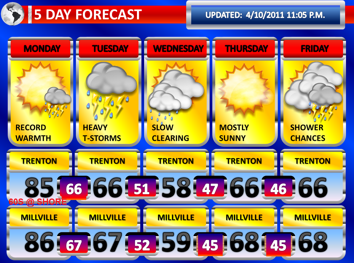
Record challenging high temperatures are anticipated for Monday, especially away from the coastline. Temperatures could approach 80 degrees or better once the sunshine comes out. I am still expecting a range of temperatures between 82 and 86 degrees. At the coast, the clearing will arrive last here and I also think the wind off the ocean will not be ideal for much better than 65-70 degrees.
On Monday Night, temperatures will be slow to cool. It is possible the readings drop a few degrees, before rising again ahead of a strong cold front arrive late Monday Night into Tuesday Morning. Thunderstorms may accompany the front. The models are not too robust with the convective activity and they are showing rapid dissipation with nightfall and as the thunderstorms enter into slightly more stable air near the Middle Atlantic Coastline. However, the nighttime temperatures of near seventy degrees will still allow for some instability to linger and at least some scattered severe thunderstorms may be possible.
The front may actually be more active on Tuesday as a wave of low pressure develops along the front as it slows down significantly over the region. There could be additional strong to severe thunderstorms on Tuesday, but there will be extensive cloudiness which could limit the potential. Heavy rainfall may be more of an impact on Tuesday. Several inches of rain could fall on Tuesday and may result in flash flooding. The first half of Wednesday could even be showery as the system takes time to gradually move out.
More showers and thunderstorms are possible on Friday with a warm front and on Saturday with a cold front.
No comments:
Post a Comment