

The Monday Night into Tuesday possible snow and sleet event is now about 54 to 60 hours away. There is a lot to iron out between now and Monday Night. The 00z guidance is now in.
The GFS from 00z suggests that the area of low pressure passing to our south will be closer to our region. This track would be somewhat warmer as a result, with the “540 Line” pushing through our region as the precipitation begins to fall. This would indicate a transition from rain to sleet and snow in areas that receive precipitation. The GFS shows a fairly decent burst of precipitation in Southern New Jersey as it continues to get colder. It looks like the model is showing some convective banding, so even some thunderstorms would be possible. Notice the sharp cutoff though. New Brunswick is not getting anything measurable while Hammonton, Atlantic City, and Cape May are getting heavy precipitation. But here is the thing if this solution were correct. Is Cape May really going to see it change to all wet snow and sleet with the “540 Line” in the location it is? This could be a situation where the heaviest burst doesn’t necessarily coincide with temperatures supportive for snow. It will be a close call.
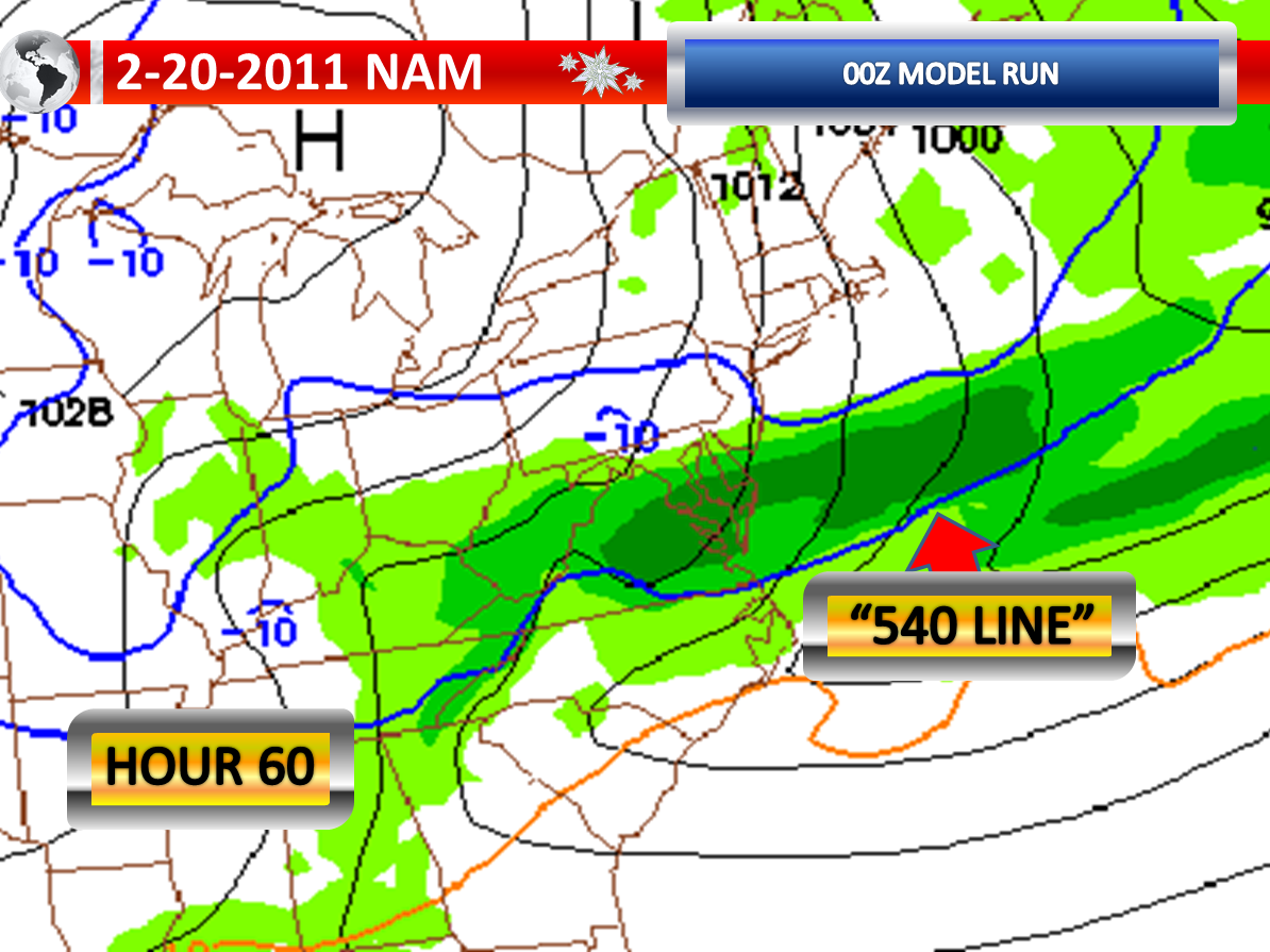
Meanwhile, the NAM shows the “540 Line” almost down into the Delmarva as the precipitation begins. But even here, some rain or mix initially would occur where it precipitates. However, it shows such a strong push of colder air, that the storm is actually suppressed by the heavier and denser air and practically misses most of New Jersey with the exception of Cape May. It shows intense banding though in Southern Delaware. So while it is cold for accumulations on the NAM, there is literally precipitation that will be non-existent if this solution were correct.
At this point, I continue to believe Southern New Jersey has the best chance at observing accumulations, if any at all. Will the surface be too warm? Will it be precipitating at all? Will the precipitation be transitioning to all frozen? These are three questions which do not have definitive answers as of early Sunday Morning.
No comments:
Post a Comment