


Trouble could be brewing.
System number one is only about eighteen hours away. The computer model guidance this morning is much colder and shows more available liquid with the 12z Guidance for Northern and Central New Jersey. The “540 Line” on both models never really lifts through Central New Jersey on both the GFS and NAM models during the heaviest precipitation. Temperatures this morning are running several degrees colder than the guidance indicated. The column also seems to be colder when peaking at the atmospheric profiles.
It would appear as though some areas may see the precipitation start as wet snow, with a mixture of sleet where the precipitation is heavy enough. There still is expected to be a transition to rain in Central New Jersey, but this could be delayed until the steadier precipitation turns lighter and more sporadic. Meanwhile, it still appears that south of the Atlantic City Expressway, the precipitation will be light and the likely conditions would be fog and drizzle. But, if heavier showers should occur here, they may contain some sleet pellets initially. It could be a very interesting temperatures situation on Monday Morning with a huge difference from north to south.
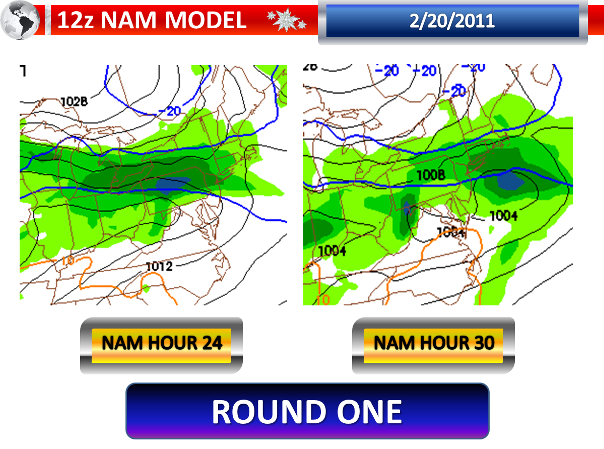
The models continue to show a lull during Monday, around midday. A second low pressure area will pass to our south on Monday Night into Tuesday. However, the 12z Guidance has trended further to the north. As you can see from the previous post, the NAM model has the heavy axis of precipitation in Delaware last night. The latest 12z NAM model shows the heart of this site’s forecast area seeing that band of heavier precipitation. Even the GFS from 12z has shifted further to the north, showing the heavier band including more of Southern New Jersey. The models also seem to be a bit colder with this storm as well, indicating a faster transition to sleet and wet snow.
With the transitioning precipitation and the bouncing back and forth on the models, it is very hard to make a snow and sleet graphic prediction. I think someone could end up with as much as four to six inches of snow and sleet when this is all said and done…but where is the question that really doesn’t have an answer at this late hour.
No comments:
Post a Comment