Showing posts with label Severe Thunderstorms. Show all posts

Thursday, April 28, 2011

Dangerous Severe Weather Threat Today: Tornado Risk


I hate to be so to the point, but this is a severe weather day for New Jersey. Severe thunderstorms are maintaining their intensity and will regain some of their strength now that the sunshine is up. The severe thunderstorms are presently across Central Maryland and Virginia into Central Pennsylvania. You want to monitor the storm cells to our southwest and those that pop-up ahead of the line.

The super cell composite and tornado composite is off the charts for New Jersey standards. Confidence of at least one tornado in the Philadelphia and New York City metropolitan areas is high for me. I think there is a decent chance of 2 or more tornadoes as well within 25 or 50 miles of a point. The primary risk is damaging wind gusts, but tornadoes are possible along with large hail.

Throughout the morning and afternoon, please stay with NOAA Weather Radio for the latest weather information or a local media source. Take action if a tornado warning or severe thunderstorm warning is issued for the region. I encourage school officials and other public safety officials to think about taking action if a severe weather watch is issued. Some sunshine has been poking through the clouds in parts of New Jersey and this is just self-destructing.

Tuesday, April 26, 2011

Severe Weather Outbreak Likely on Thursday...May Include Tornado Potential


It is early on Tuesday Morning. I have been up very early into the morning analiyzing some of the latest computer model guidance regarding a potential dangerous outbreak of severe thunderstorms on Thursday. On paper, I haven’t seen such a good possibility of severe thunderstorms since the outbreak last summer which brought a 76 MPH wind gust to Philadelphia International Airport.

Damaging wind gusts on Thursday look like a very good possibility at this present time. However, the computer model guidance also is suggesting a lot of key players that would also make tornadoes a possibility. This is three days out and a lot could change. However, if the current projections are handling the event correctly, it appears there will be a lot of shear in place that would allow for the development of tornadoes, in addition to damaging winds and large hail. Not everyone will see damaging wind gusts or a tornado as is usually the case. But there could very well be more reports than usual of these elements.

The North American Model is currently the most robust with the potential of severe weather and that is because the time frame of this activity has it arriving in the late afternoon and early evening hours when daytime heating is maximized. The Global Forecast System model is earlier with the arrival of the thunderstorms, around early afternoon. However, even this model is showing some pretty nasty thunderstorm development.

In addition to the severe weather, heavy rainfall and frequent cloud to ground lightning is possible. The warm and humid conditions will make for ripe conditions for thunderstorm development, especially the more sunshine we observed prior to the thunderstorms on Thursday.

We may have scattered thunderstorms on Wednesday which will be the result of tropical moisture being pulled into the region from a disturbance that will be over the Atlantic Ocean. The tropical disturbance could enhance some thunderstorms in parts of the region on Wednesday afternoon and while scattered, heavy rainfall perhaps to excessive amounts locally will be possible. Should we see decent heating prior to that time, some of the thunderstorms may even become severe.

Sunday, April 24, 2011

Severe Thunderstorm Watch Until 9 p.m. for Most of NJ

6:15 update:


A severe thunderstorm watch has been issued until 9:00 p.m. for the following counties:

In New Jersey: Atlantic, Burlington, Camden, Cape May, Cumberland, Gloucester, Salem, Ocean, Monmouth, Mercer, and Middlesex.


A severe thunderstorm watch means conditions are favorable for the development of severe weather including large hail and damaging winds. Severe thunderstorms can sometimes produce tornadoes with little or no warning.


The current surface analysis currently shows CAPE values of 1,000 j/g to 1,500 j/kg across much of Central and Southern New Jersey. Low-level lapse rates are around 8 c/km right now which is pretty steep. The lifted index values currently are in a range of -3 to -5. The supercell composite is suggesting values of 0.50 to 2 region wide. The significant hail composite is showing values of 0.50 to 1.50 across Southwestern New Jersey which the Derecho Composite showing values of 1 to 4.

What this all basically means is that there appears to be sufficient instability for thunderstorms to turn rapidly turn severe should there be any forcing mechanism to initiate them. What I think could do the trick is an area of thunderstorms that is beginning to redevelop over Maryland and Virginia. This could cause some very late afternoon and especially early evening scattered thunderstorms to form. These thunderstorms have the potential to form as line segments and supercells.

Most of the region has warmed well beyond the model guidance this afternoon with high temperatures so far in the 82 to 84 degree range. A localized sea breeze front may cool things down in portions of the coastal counties, but elsewhere it should remain quite warm and unstable until the sun begins to set this evening. The sea breeze front itself may serve as a focus for thunderstorm initiation if it begins to interact with the convection that should develop and transpire to our southwest.

Saturday, April 16, 2011

Very Windy and Wet This Evening and Tonight


Major storm headed towards the region this evening into tonight.

All of North and most of Central New Jersey is now under a flood watch. The NAM has widespread purple coloring indicating a quick 1.50 to 1.75 inches of rain in less than six hours during the time frame of convection which I suspect may lead to some localized flash flooding. Total rainfall of 1.75 to 2.50 inches looks to be a good bet for much of the region. Bucks, Montgomery, Eastern Berks, and Eastern Lehigh Counties into North-Central New Jersey need 1 to 2 inches in less than 6 hours for flash flooding to begin. Elsewhere in Pennsylvania…2 to 3 inches of rain would be needed for flash flooding to begin. In Southern New Jersey, rainfall amounts of 3 to 4 inches would be needed for flash flooding to begin and the sandier soil will make this area less vulnerable to flooding. If the NAM is correct, the heaviest rain would be right over the Delaware River and Interstate 95 corridor.


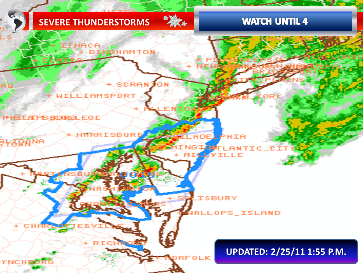
We also may be dealing with thunderstorms that could contain damaging wind gusts. Right now, the Storm Prediction Center has the slight risk for severe thunderstorms for portions of Southern New Jersey. I think it is possible that they will extend the risk area further northward in later outlooks. The North American Model and some of the high resolution models show clearly that a line of convection… pushing from west to east between 8:00 p.m. and 11:00 p.m. …will impact the region. Basically, a low or meso-low will develop a cold front pushing towards our region. The low will energize the front. Moisture will be streaming in from the fetch off the Atlantic and combine with the Gulf Moisture that is open for business. All of this suggests a super soaking and a good feed into a line of convection. The National Weather Service is concerned significant wind damage may occur east of this line in New Jersey and I couldn't agree with them more.

We also will be dealing with wind issues that are non-convective related. We have had some decent soakings and this will be another one. The ground will be wet enough to be supportive of an increased risk for trees to become uprooted in strong winds. Unfortunately, it looks like the jet intensifies by mid-evening during the timing of the heavy rain which could transfer the momentum down to the surface. Non-thunderstorm wind gusts of 40 to 50 MPH appear likely, perhaps higher than 50 MPH along the coastline. The National Weather Service has issued a wind advisory which implies sustained winds of 31 to 39 MPH or frequent wind gusts of 46 to 57 MPH are imminent or occurring. This is in effect from noon today until midnight tonight. The gradient looks tight enough that even when it is not raining...gusts of around 45 MPH will occur.

The strong onshore winds will also pose a risk for widespread minor coastal flooding, with scattered areas of moderate coastal flooding. A coastal flood warning has been issued for the tidal areas of the Delaware River and the entire New Jersey/Delaware Atlantic coastline.

* AT SANDY HOOK... NEW JERSEY (RARITAN BAY)... HIGH TIDE OCCURS
AT 720 PM... WITH A FORECAST TIDE LEVEL OF 7.5 TO 8.0 FEET
ABOVE MEAN LOWER LOW WATER.

* AT SEASIDE HEIGHTS... NEW JERSEY (OCEANFRONT)... HIGH TIDE
OCCURS AT 650 PM... WITH A FORECAST TIDE LEVEL NEAR 7.0 FEET
ABOVE MEAN LOWER LOW WATER.

* AT ATLANTIC CITY... NEW JERSEY (OCEANFRONT)... HIGH TIDE
OCCURS AT 657 PM... WITH A FORECAST TIDE LEVEL NEAR 7.0 FEET
ABOVE MEAN LOWER LOW WATER.

* AT CAPE MAY... NEW JERSEY (OCEANFRONT)... HIGH TIDE OCCURS AT
731 PM... WITH A FORECAST TIDE LEVEL OF 7.5 TO 8.0 FEET ABOVE
MEAN LOWER LOW WATER.

* AT BREAKWATER HARBOR... DELAWARE (DELAWARE BAY)... HIGH TIDE
OCCURS AT 809 PM... WITH A FORECAST TIDE LEVEL NEAR 7.0 FEET
ABOVE MEAN LOWER LOW WATER.

* AT REEDY POINT... DELAWARE (DELAWARE BAY)... HIGH TIDE OCCURS
AT 1041 PM... WITH A FORECAST TIDE LEVEL NEAR 8.5 FEET ABOVE
MEAN LOWER LOW WATER.

* AT PHILADELPHIA... PENNSYLVANIA (DELAWARE RIVER)... HIGH TIDE
OCCURS AT 112 AM SUNDAY... WITH A FORECAST TIDE LEVEL OF 9.0 TO
9.5 FEET ABOVE MEAN LOWER LOW WATER.

* HIGH TIDE OCCURS ON BACK BAYS AND TIDAL TRIBUTARIES LATER THAN
IT DOES ALONG THE OCEANFRONT.

* WAVES...WAVE HEIGHTS IN THE SURF ZONE ALONG THE OCEANFRONT MAY
BE IN THE 5 TO 8 FOOT RANGE.

Tuesday, April 12, 2011

Severe T-Storm Line


11:52 p.m. UPDATE:

We have been really getting hit tonight with some inclement weather, especially in Southern New Jersey. Numerous thunderstorms developed tonight. The first around rush hour produced frequent cloud to ground lightning and very heavy rainfall. The second, late tonight prompted severe thunderstorm warnings for quarter sized hail and damaging winds in excess of 60 MPH. Numerous reports of 30 to 45 MPH wind gusts were reported between 9:00 p.m. and 11:00 p.m. It is too early to confirm wind damage reports with the thunderstorm line, but power outages have been reported in the counties in which it moved over…but some of these outages could also be related to the strong, non-thunderstorm wind gusts.

The second line prompting the warnings is ongoing due to elevated warm air advection. The warm air is aloft as the marine flow is at the surface. The marine flow just hasn’t been able to win out tonight with the stable, oceanic air that typically keeps a cap on the development of thunderstorms. A strong jet aloft and a relatively cold pool of air has been responsible for the hail and wind.
East-northeast winds will be gusty and additional showers and thunderstorms are possible through the overnight.


So far Atlantic, Burlington, and Ocean Counties have been under a severe t-storm warning.

Monday, April 11, 2011

Possible Severe Thunderstorms Tonight

5:00 p.m. UPDATE:

The cluster being eyed has really weakened...but within the next two hours it may develop or another line segment may form along the outflow boundary. The cluster weakened before entering the instablity axis the derecho composite illustrates clearly with 2-4 values. Tornado composite values have increased to 0.50-1.00 now with CAPE of 1,500 j/kg. CIN isn't good for development though...and I would like a closer forcing mechanism. We lose sunlight too in about 3 hours.


A cluster of thunderstorms has developed ahead of a cold front this afternoon near State College, Pennsylvania. This cluster is moving eastward and will move into New Jersey, should it survive, this evening and tonight.

The cluster of thunderstorms is likely going to become more organized as it moves eastward, until at least nightfall. Temperatures have soared into the middle eighties, as anticipated, with the exception of the immediate coastline. The record warmth has cause CAPE values to approach 1,000 j/kg and therefore there is sufficient instability to feed on for at least the first half of tonight before some of it could dissipate.

Damaging wind gusts will be the primary threat, but an isolated tornado threat is not out of the question, especially the closer to Pennsylvania. The tornado composite does suggest the opportunity for a tornado. I expect the cluster to also expand in size as it approaches more unstable air.

Tuesday, April 5, 2011

Damaging Winds Pushing Through with Severe T-Storms


Very heavy showers and thunderstorms...with little lightning...is tapping into strong winds aloft and is producing severe weather in the form of damaging winds...especially south of Interstate 195 where numerous severe t-storm warnings are in effect.

Monday, April 4, 2011

Windy Afternoon....Overnight Thunderstorms With Damaging Wind Potential

3:40 p.m. update:
A wind advisory has been issued for Burlington, Camden, Ocean, Gloucester, Salem, Cumberland, Atlantic, and Cape May Counties from 2:00 a.m. to 11:00 a.m. Tuesday. The current wind advisory remains in effect for Southeastern Burlington, Cumberland, Atlantic, and Cape May Counties until 6:00 p.m.

Red Flag Warnings have been posted for Burlington, Ocean, and Camden counties until 6:00 p.m.


A look at the visible satellite imagery this morning shows that sunshine is beginning to become more prevalent south of the warm frontal boundary. Additional breaks in the clouds should develop from the south and west and move northeastward through the afternoon hours. It is anticipated that much of New Jersey is observing mostly sunny skies by later this afternoon. It is at this time, when the sunshine develops, temperatures will begin to rise dramatically. It is already doing so in Southern New Jersey and therefore this clearly will be the warmest area today. It is 44 degrees in New Brunswick and 58 degrees in Vincentown as of 10:15 a.m.

The sunshine and rising temperatures will begin to mix the air and this may transport strong winds aloft to the surface. Winds will become sustained between 20 and 35 MPH with gusts to 50 MPH. The highest chance is over the wind advisory area, but I can see the wind potential developing across the entire region should sunshine break out. Some portions of South Jersey could reach near 80 degrees. Most of the region will push well into the seventies once the sunshine is out for several hours, after being stuck in the mid to upper forties at this hour in the north.

Southeastern Burlington, Atlantic, Cape May, and Cumberland Counties remain under a wind advisory.

A red flag warning may be issued later today for portions of Southern New Jersey. With the rain overnight and dew points well above the threshold for a warning, the conditions may not technically meet warning conditions. However, a drying wind and mixing will drop the dew points some for a time. In addition, the strong winds and very warm temperatures will make for as good of conditions as you can get for rapid spread of fire should one develop without meeting the moisture criteria, technically speaking.

Meanwhile, I will be watching a widespread severe thunderstorm outbreak to our west this afternoon into tonight. Tornadoes, damaging winds, and large hail will become common out to our west, including but not limited to Pittsburgh. Late tonight, this line will be driven across Central Pennsylvania. The North American Model and Global Forecast System models show that at this time the line weakens, but it still maintains itself to some degree all the way to the New Jersey coastline early on Tuesday Morning. With strong winds continuing to be indicated aloft, even the modest convection will be able to transport strong winds to the surface. Therefore, it won’t take the strongest convection to develop some pockets of damaging wind gusts in our area.

Sunday, March 6, 2011

Flooding and Strong Wind Gusts


The entire state is under either a flood advisory or a flood warning. Rain continues to fall very heavily. Some portions of New Jersey have already seen two inches of rain in just less than three hours. I am watching a general area of showers that are already pushing north and east. But behind that is a small, miniature line of embedded thunderstorms moving from Burlington County in Ocean and Monmouth Counties. These storms could contain wind gusts past 40 MPH easily.


There could be a break in the activity for a few hours and then a squall-line could remain intact and move north and east towards New Jersey. This line has prompted a tornado watch box to our south and poses the risk for damaging wind gusts where it tracks. We will have to wait and see whether this will impact our region, and there is a chance it may. This band has formed with what we call a low-level confluence zone, right on the heels of cold air advection or the cold front. Remember, I have been warning that when the surface low passes and the cold front we may see the winds gust past 50 MPH. This could be the activity that does in fact cause the strong wind gusts.

Very Heavy Rain and Thunderstorms On The Way


The threat for heavy rain this evening and overnight continues across New Jersey. While we have had some scattered heavy showers this morning, the main course is waiting to impact us. The radar picture just after noon showed a surface low beginning to develop and intensify along a slow moving cold front moving eastward. Rich gulf moisture and moisture from the Atlantic can be seen injecting itself into the surface low. The low is currently around the Southern Appalachians. The low will move into the Carolina Piedmont and eventually eject northward into our region. As the system gets closer to our region, both the front and the low will begin to develop some heavy, steady rainfall. The heaviest axis of rain will setup in Northwestern New Jersey down through Eastern Pennsylvania. The NAM and GFS models show even heavy rain in Cape May, but I am still expecting lesser amounts in our southeastern counties. The higher resolution models aren’t as robust as the morning GFS and NAM on torrential rain at the shore points.

With New Jersey in the right guardant of this low, I expect it to turn windy for at least a short period of time. Wind gusts of near or in excess of 50 MPH certainly are possible as the front pushes through and the surface low moves to the north and east. With the wet ground, these wind gusts may be able to uproot trees. The heavier rain could be able to transport the stronger winds to the surface. The right quadrant also means that there could be some marginal instability for some thunderstorms. The models indicate low-topped convection with the actual surface low itself, regardless of if you will be on the right side. Any convection will be underneath all of this heavy rain. These situations pose a challenge to detect wet microbursts or a weak tornado, but these are certainly possible with any thunderstorm given the setup.

The high resolution models show cold air catching up with the precipitation on Monday Morning prior to and during the morning commute. It could be cold enough to change the precipitation to sleet and wet snow in our Northwestern Counties. The setup leaves me still with some doubts, but it can happen and one must maintain an eye on the credible models suggesting this possibility.

Monday, February 28, 2011

Thunderstorms Threaten This Afternoon


Central and Southern New Jersey remains under a slight risk designation for severe weather. A cold front will be approaching this afternoon and the region is now under the warm sector of a warm front. The clouds are thinning as the satellite imagery indicates across Central and Southern New Jersey. The sunshine is allowing temperatures to spike and increasing the instability. It is now 67 across areas as far north as Burlington County.

While the line of thunderstorms may not look like much now, it is still in areas that have been mainly cloudy and therefore somewhat stable. Once the line enters our region, there is a good possibility it will rapidly intensify. With strong winds aloft, any heavy downpours could pull the wind to the surface and spread it out which would give us a potentially damaging downdraft in spots. High shear may pose an isolated tornado risk. Tornado watches are in effect for the Washington D.C. and Baltimore metro areas and we will have to see if any watches are expanded into our region.

The line is considerably earlier than previous guidance had indicated and the late morning guidance has a weaker line pushing through as a result, but it still shows a fuse being lit as it enters South Jersey and Delaware.

Friday, February 25, 2011

Severe Line Prompting Severe T-Storm Warnings


By the way...here is what comes about two-three hours after the line:

Lancaster, PA Airport and Hagerstown, MD are reporting a sustained wind of 41 MPH (tropical storm force sustained wind)! ! ! !

Damaging Winds and Power Outages Likely By Evening


The Storm Prediction Center this morning placed most of Central and Southern New Jersey under a slight risk for severe weather. The Storm Prediction Center is not forecasting hail, but they are forecasting a probability of damaging wind gusts even an isolated tornado. The environment does have increasing shear, so a tornado concern would not be completely unwarranted by any means. But very severe winds aloft can easily be transported to the surface with any thunderstorm and therefore the risk of damaging winds is the primary concern.

The limiting factors for thunderstorms could be the real lack of sunshine. However, there still is some very modest instability with the warm sector now arriving in place. Temperatures will continue to increase, reaching the lower sixties to mid-sixties in most of Southern New Jersey. Dew points will also continue to increase and there will be rich moisture to work with.

Meanwhile, it will not take thunderstorms to produce very high winds this afternoon and this evening. A high wind warning is in effect for the potential of widespread damaging wind gusts as the front approaches and passes. Strong northwesterly winds are associated with an area of low pressure passing through Pennsylvania, which will eventually pass through New Jersey. It will be behind this low that we see the strongest gusts for a few hours. We received the heavy rain and some more heavy showers and thunderstorms could be on the way. Therefore, the ground will be saturated just in time for these strong winds increasing the chance of whole trees coming down, something the expected wind gusts in excess of 58 MPH will already be capable of doing with even a dry ground.

Widespread power outages are possible as a result of the high winds. This could be a situation that leads to outages that may be of long duration. Temperatures could fall more than 30 degrees across areas that get into the sixties in just three to four hours and with a driving wind, homes will cool down rapidly as the temperatures drop. This could cause some communities to enact shelter plans. More than 50,000 people could lose power in New Jersey if the worst case scenario is realized.